Sixense was commissioned to carry out a complete geophysical survey at the foothills
Al Ain is a fertile oasis city located approximately 160 km east of the Abu Dhabi capital.
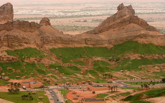
Jebel Hafeet, a mountain reaching 1,249 m, is overlooking the city and intersects part of the border with Oman. At the foothills of Jebel Hafeet lies the Green Mubazarrah, a well developed tourist attraction including swimming pools, hot water springs and even a wide range of animals.
The future social and economic plans for Al Ain City reveal that the city is entering an exceptional construction evolution. This evolution requires taking into consideration all the necessary measures to ensure the safety of the people and the development.
The top priority is therefore to map the subsurface and characterise the shallow stratigraphy in order to highlight areas of anomalous response resulting from possible subsurface cavities, Falaj (underground aqueducts), solution features, very weak and less dense subsurface areas. This mapping aims to demarcate the zones which might endanger the future construction activity.
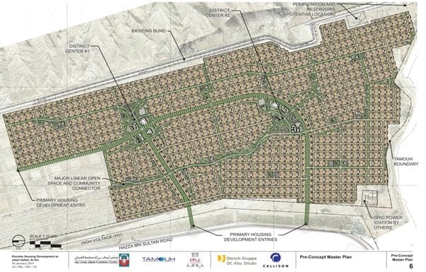
In this context, Sixense was commissioned in January 2011 to carry out a complete geophysical survey at the foothills of Jebel Hafeet, targeting the proposed footprint for the construction of 3,000 villas spread over 1,400,000 sqm.
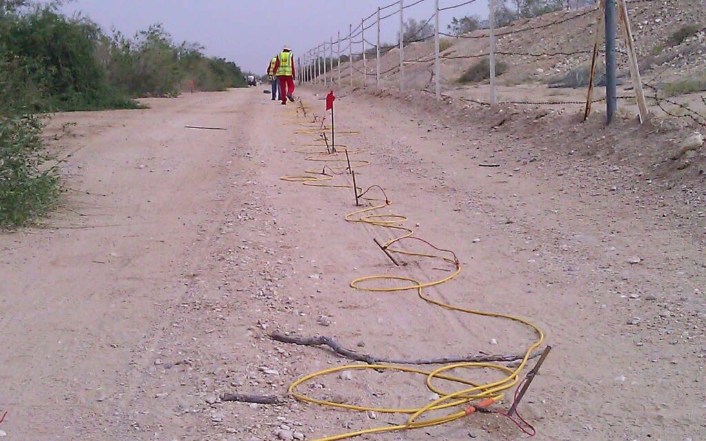
Results of the Electrical Resistivity Tomography (ERT) geophysical investigations, carried out to depths of up to 30m with a big team (about 40 people), were later verified by a geotechnical investigation to prepare a risk map highlighting the potential anomalous areas prior to starting construction of the housing project.
Images of the project
Calibration Boreholes
Terrameters with 64 electrode lines
People on site for 3 months