The Fountain Landslide
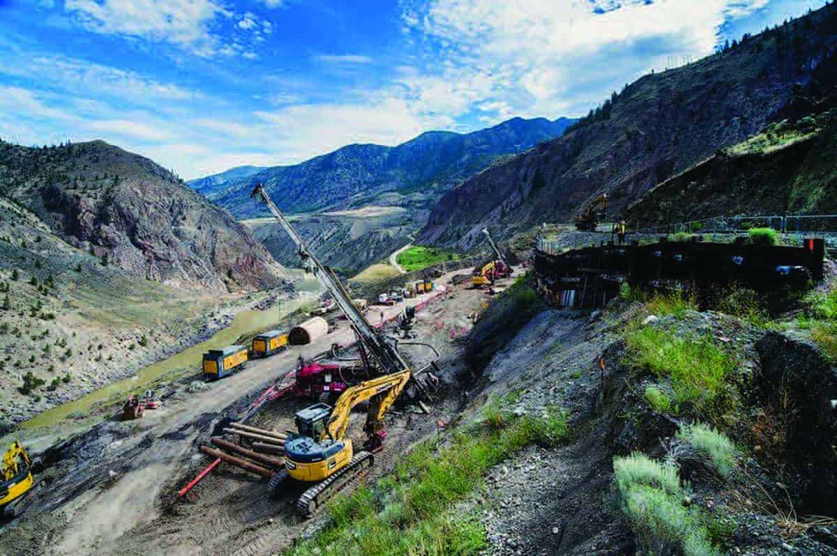
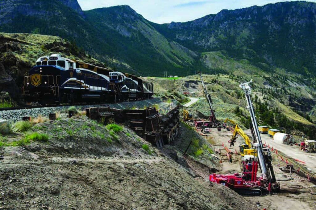
The Fountain Landslide is an ancient earthflow located about 16 km northeast of Lillooet, British Columbia (BC). The landslide has been active for decades and affects Highway 99 and the BC Rail line, which is currently owned by the Canadian National Railway. The slide is 205 m wide at Highway 99 and extends from just below the rail tracks (located 55 m above the highway) down to the Fraser River (approximately 85 m below the highway). The slide mass incorporates around 750,000 m³ of material.
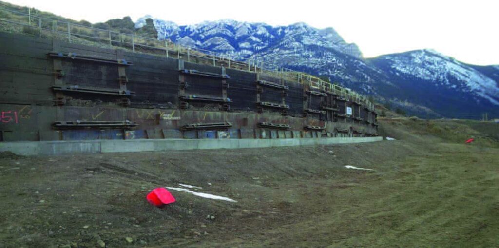
In 2016, movements had been accelerating for the last couple of years, moving approximately 4 to 10 mm per day. Therefore, a design-build repair was required, which involved installing micropiles and ground anchors to buttress and stabilizing the existing remaining structure.
Monitoring the Fountain Landslide
Throughout the repair construction, active ground movement was expected during the early stages of the work. Due to this expected movement, the project team and client wanted to monitor the movement of the retaining structure in near real-time throughout the construction to easily evaluate the effects of the work and deliver early warning alarms to all the involved parties in the case of excessive movement.
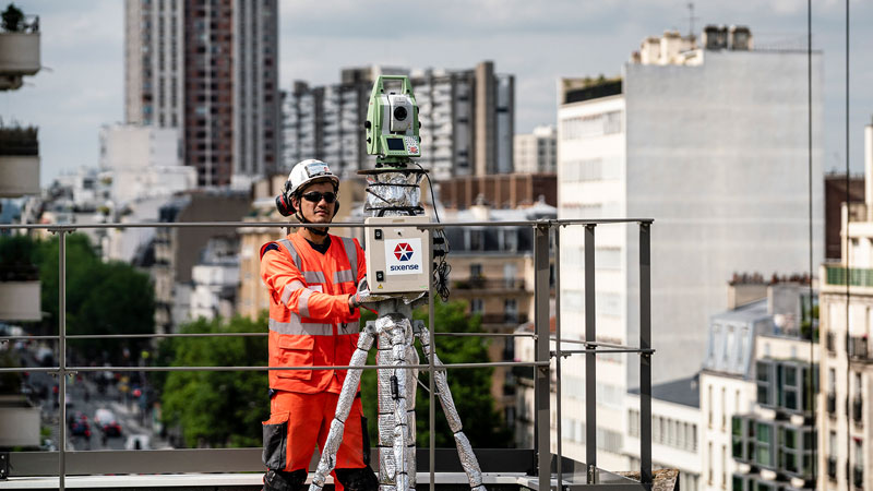
Sixense planned to operate the monitoring system continuously and report monitoring data in short time intervals throughout the project. Therefore, a system consisting of patented Cyclops (AMTS) and several monitor prisms attached to the H-piles of the existing retaining wall was deployed by the company.
Lack of Internet Access
When Sixense works in remote locations with little to no cellular and terrestrial internet service, the lack of connection can prevent transmitting important monitoring data to engineers and decision-makers promptly, isolating field engineers from the outside world to obtain technical assistance or rescues under emergencies. This is prominent in historical slide sites, such as The Fountain Landslide.
The remote site did not have terrestrial internet service, so a subscribed satellite internet service was purchased to provide wireless communication to the system for AMTS remote control and data uploading. This feature allowed field engineers to access the monitoring web portal to obtain relevant data via their tablet or smartphone anytime they were nearby.
Final Takeaways
Although a significant movement was observed during the early stages of construction, the design engineer was able to quickly and remotely evaluate the occurrence. This helped ensure the movements were within a threshold of tolerable ranges and under control.
In addition, Sixense’s monitoring data showed a trend of horizontal movement:
- 20 mm/day before the construction
- 5 mm/day during construction
- 1 mm/day at completion
Images of the project
Similar projects